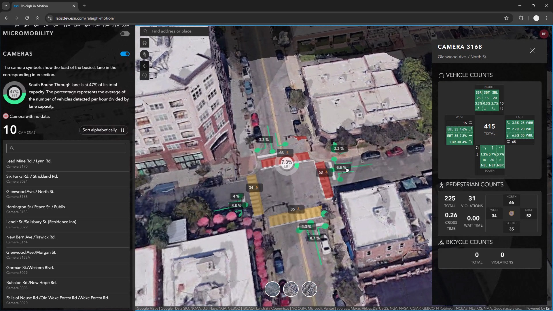
The City of Raleigh has launched the "Raleigh In Motion" digital twin pilot project using AI to analyze real-time traffic data. Nvidia AI technology processes video from hundreds of city cameras to identify vehicles, bikes, and pedestrians. This data is integrated into Esri ArcGIS, enabling officials to monitor congestion levels at key intersections with color-coded indicators. The system also flags incidents like stalled vehicles affecting traffic flow. By combining Nvidia's computer vision with Esri's GeoEvent Server, Raleigh aims to identify dangerous intersections, reduce congestion, and improve safety for all road users. This initiative allows city planners to respond promptly to incidents and strategically plan infrastructure improvements based on detailed traffic insights.
Is your firm ready for what’s next?
VisioneerIT helps AECM and government contractors modernize operations, achieve compliance, and implement AI.
Explore VisioneerIT Solutions →Tracking the right federal opportunities?
OryonIQ's AI platform monitors agency forecasts, contract awards, and procurement timelines — so government contractors always know what’s coming next.
Try OryonIQ Free →